🌊 A Climate-Ready Vision for Morro Bay and Los Osos
A quick look behind the scenes of our latest project in Morro Bay.
By: Juliano Calil
Posted:
Many great community stories begin with a challenge and a shared vision to overcome it. Along California’s Central Coast, the road linking Morro Bay and Los Osos has long been a lifeline connecting people, neighborhoods, and nature. But with stronger storms and rising seas, that connection is being tested. Now, a powerful collaboration is taking shape to reimagine how we move through this changing landscape.
Visualizing Change
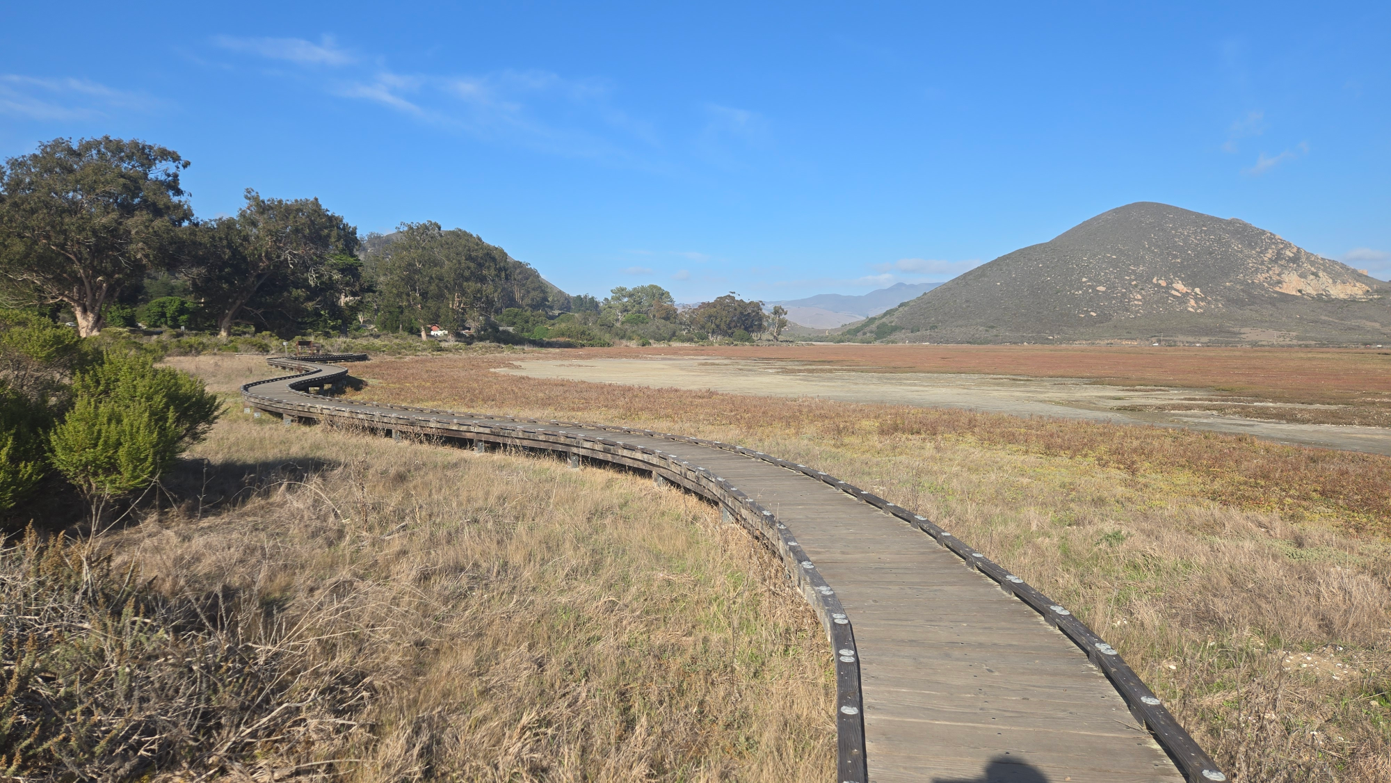
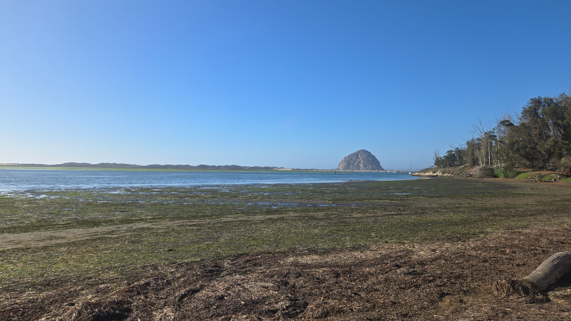
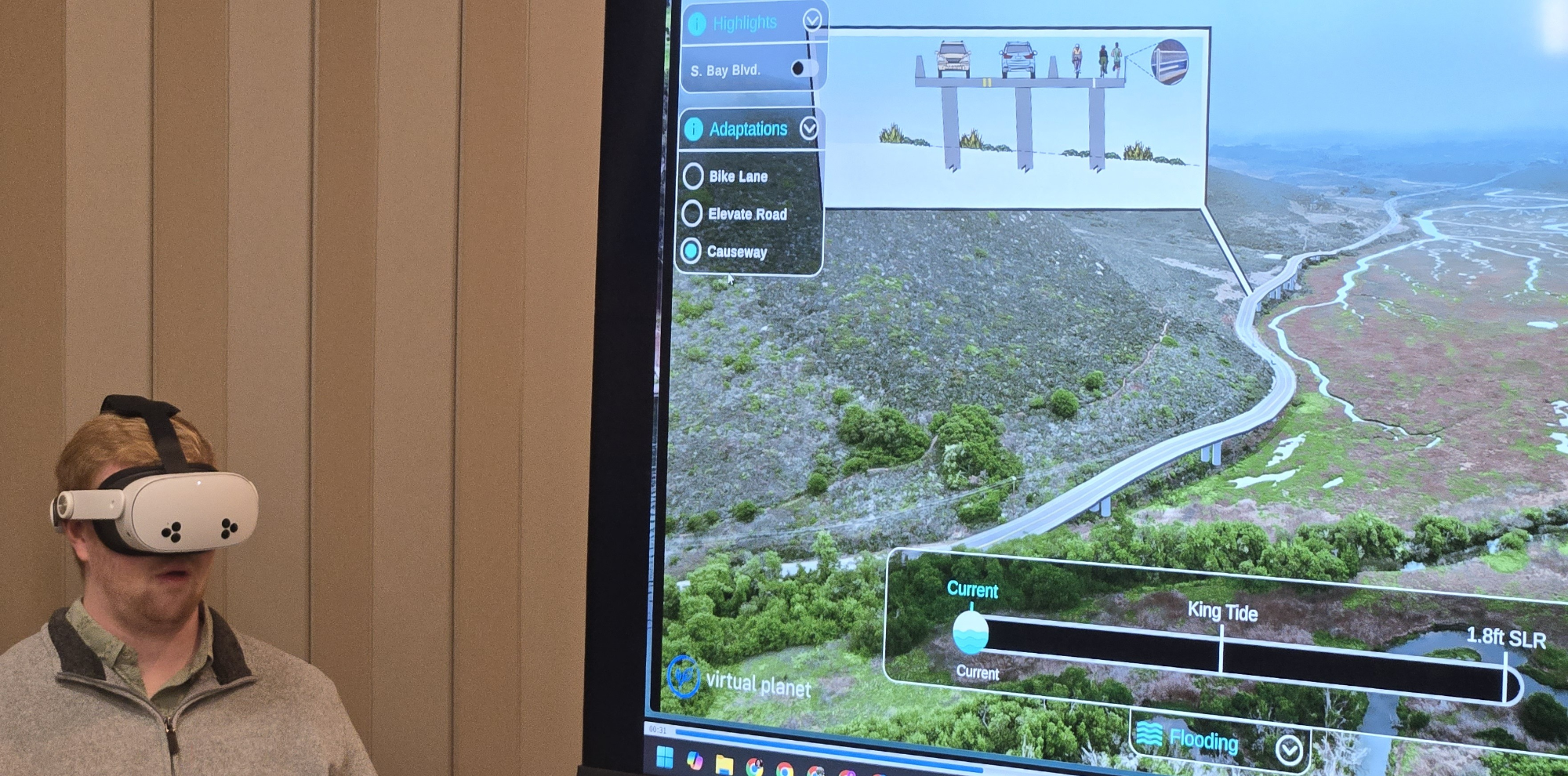
In Morro Bay, this work meant partnering with local and regional teams to visualize how different levels of sea-level rise and storms could affect key roads, wetlands, and neighborhoods.
Drone flights quickly became a puzzle of timing, weather, and permits. Coastal fog rolled in without warning, grounding flights mid-mission. It took three trips (and a lot of flexibility) to capture what was needed. In the end, the footage revealed the wetlands, state park, and critical roads just as residents experience them.
Building the Morro Bay Estuary Climate Resiliency Transportation Plan
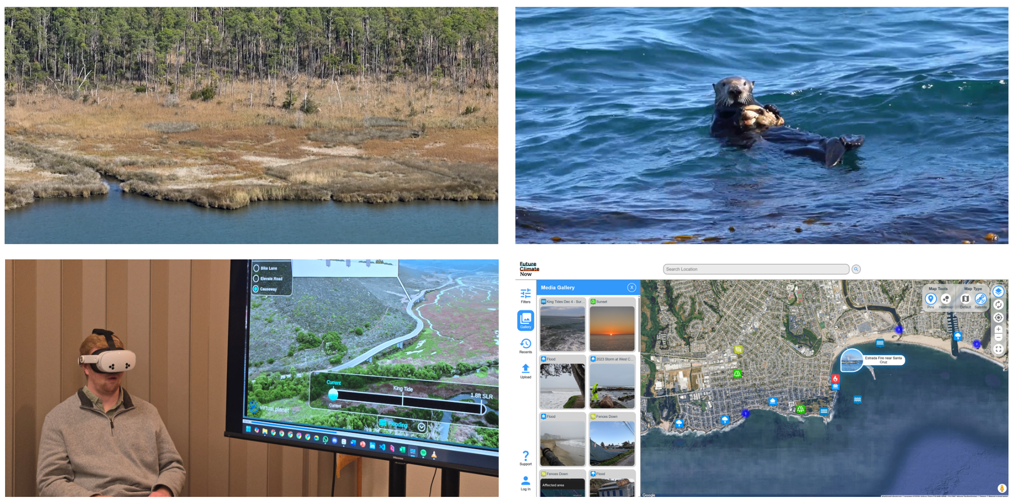
The San Luis Obispo Council of Governments (SLOCOG), together with Environmental Science Associates, RRM Design Group, the Middlebury Institute of International Studies, and Virtual Planet Technologies, is developing the Morro Bay Estuary Climate Resiliency Transportation Plan, a blueprint for the future of mobility, safety, and sustainability across the estuary.
The Plan focuses on a 2.5-mile stretch of South Bay Boulevard, a corridor that runs through wetlands, tidal creeks, and the Morro Bay State Marine Reserve. Recent flooding has shown just how vulnerable this route is, and why it’s time to plan ahead considering transportation and climate resilience.
Seeing the Future
To make scientific projections and models more accessible, the project includes immersive storytelling tools like the Sea Level Rise Explorer: Morro Bay, an online and VR experience where residents can explore flooding scenarios, visualize adaptation ideas, and see how sea-level rise and storms could reshape familiar landscapes. These tools are also available online to support a broader community conversation, helping people engage directly with the data and explore design options that protect mobility, habitats, and neighborhoods.
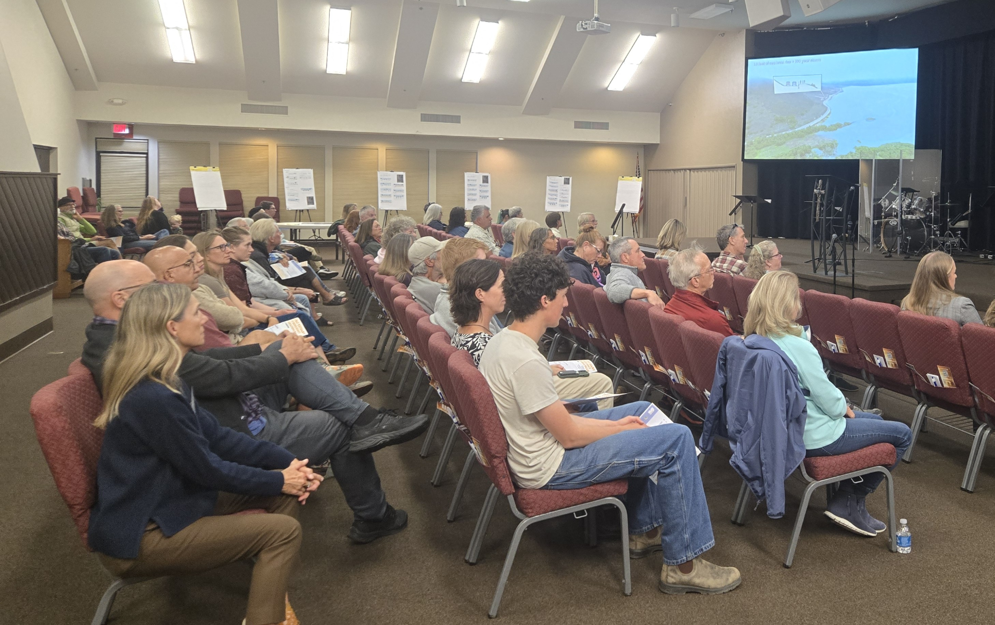
Community Collaboration
Public workshops are being held to share progress, gather input, and shape next steps. Every idea helps refine a shared vision for a more connected and climate-ready Central Coast - one that supports recreation, access, and environmental protection.
Funded by the Caltrans Sustainable Transportation Planning Grant Program, the project will guide future design and implementation efforts that improve both safety and resilience.

👉 Learn More and Get Involved
At Virtual Planet, we believe immersive technology can strengthen community understanding and inspire action. Experience the Sea Level Rise Explorer: Morro Bay and explore how the community is planning for a safer, more connected future.
🔗 Immersive Experience: virtualplanet.tech/morro-bay
🔗 Project Page: sbbclimateplan.org

Read Also
Three Coastlines, a New Platform and a Free Video
New experiences, Future Climate Now, and a question for you.
What We Learned When People Stopped Paying Attention
A 2025 recap from Juliano Calil on how immersive engagement shifted from novelty to practical tool, based on real-world climate and resilience projects. Lessons on attention, storytelling, and why immersive tools now need to deploy fast, stay grounded in place, and drive action.
Virtual Planet FAQ: Climate Visualization & Immersive Storytelling
Answers to the most common questions about Virtual Planet's work.
🎥 Behind the Headsets: Immersive Climate Stories for Coastal Resilience
Co-creating across coasts to transform data into experience.